Chesapeake Bay Climate Adaptation Toolbox
Eastern Virginia Coastal Resilience (ESVA Coastal Resilience)
Developed By: National Oceanic and Atmospheric Administration (NOAA), and The Nature Conservancy (TNC)
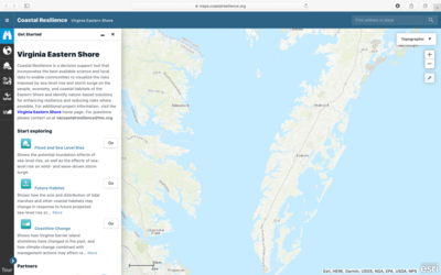
Summary: The Virginia Eastern Shore Coastal Resilience tool is an interactive mapping tool that allows users to visualize potential social, economic, and environmental impacts of sea level rise and storm surge and identify areas for nature-based solutions to enhance resilience and reduce risks where possible.
In this tool, users can explore five modules to visualize and map the potential impacts of sea level rise and storm surge on Virginia’s Eastern Shore. In each module, referred to as “apps”, users can examine different aspects of coastal vulnerability and resilience related to regional planning, flooding and sea level rise, living shorelines, future habitats, and coastline change. In the Regional Planning app, users can display a variety of data layers such as administrative boundaries, critical infrastructure, coastal habitats, and socioeconomic information. In the Flood and Sea Level Rise app users can also view the potential impacts of sea level rise and storm inundation on coastal infrastructure and habitats. The Future Habitat app allows users to examine how the size and distribution of tidal marshes and other coastal habitats may change in response to future sea level scenarios. The Coastline Change app shows how Virginia barrier island shorelines have changed in the past, and how climate change and management actions may affect future rates of shorelines change. Lastly, the Living Shoreline Explorer app provides a screening tool for nature-based shoreline stabilization as well as a marsh vulnerability index.
This tool was designed with feedback from a variety of local stakeholders and does not require any advanced training or experience. The web portal provides a welcome guide describing each application, as well as a short introductory video, step-by-step tutorial, and factsheets about how to use each app. Users can also easily find metadata to access original local, state, and federal data where available.
Get This Tool: https://maps.coastalresilience.org/virginia/
Geographic Coverage
- Accomack County, VA; Northampton County, VA; Assateague Island, VA; Wallops Island, VA; Assawoman Island, VA; Metompkin Island, VA; Cedar Island, VA; Parramore Island, VA; Hog Island, VA; Cobb Island, VA; Wreck Island, VA; Ship Shoal Island, VA; Myrtle Island, VA; Smith Island, VA; Fishermans Island, VA
Tags
- Real-time/Current
- Climate projections
- Grid based
- Regional level
- Computer application
- Interactive interface/map
- Compare scenarios/locations
- Downloadable results
Cost
- Free
Skill Level
- Low