Chesapeake Bay Climate Adaptation Toolbox
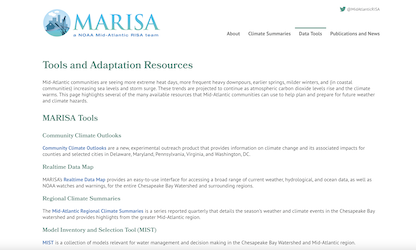
MARISA Data Tools
Developed By: Mid-Atlantic Regional Integrated Sciences and Assessments (MARISA) program
Summary: The NOAA Mid-Atlantic Regional Integrated Sciences and Assessments (MARISA) Data Tools is a data center for the Chesapeake Bay Watershed and broader Mid-Atlantic region. This site is constantly being updated with new weather, climate, and natural hazards data sources and tools.
Get This Tool: https://www.marisa.psu.edu/
Geographic Coverage
- Delaware; District of Columbia; Maryland; New Jersey; New York; Pennsylvania; Virginia
Available Tools
- MARISA Data Tools: Climate and Hazard Mitigation Planning (CHaMP) Tool
- MARISA Data Tools: Realtime Data Map
- MARISA Data Tools: Community Climate Outlooks
- MARISA Data Tools: Projected Intensity-Duration-Frequency (IDF) Curve Data Tool for the Chesapeake Bay Watershed and Virginia
- MARISA Data Tools: Model Inventory and Selection Tool (MIST)
- MARISA Data Tools: Mid-Atlantic Climate Data Tools
- MARISA Data Tools: Regional Climate Summaries
Cost
- Free
Skill Level
- Low