Chesapeake Bay Climate Adaptation Toolbox
Sea Level Report Cards
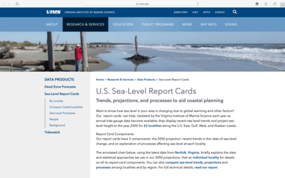
Developed By: Virginia Institue of Marine Science (VIMS) Center for Coastal Resources Management (CCRM)
Summary: The Sea-Level Report cards provide interactive graphs and narrative descriptions of sea-level trends and projections for 32 coastal locations across the U.S.
This easy-to-use tool allows users to view trends and future projections of monthly mean sea level to the year 2050. The report cards also describe local processes affecting sea-level trends and allow users to compare trends across different locations. The report cards are updated annually as new water level data become available.
Get This Tool: https://www.vims.edu/research/products/slrc/
Geographic Coverage
- Coastal Contiguous United States
Tags
- Historical
- Climate projections
- Location specific
- Website
- Downloadable results
Cost
- Free
Skill Level
- Low