Chesapeake Bay Climate Adaptation Toolbox
FloodFactor
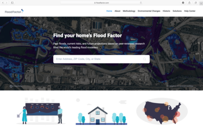
Developed By: First Street Foundation
Summary: FloodFactor is a flood risk mapping tool that shows the extent of potential inundation from tidal flooding and hurricane storm surge on the East and Gulf coasts of the U.S.
This easy-to-use tools allows users to search for or zoom to an area of interest to view the potential extent of 5 different local flooding scenarios: frequent tidal and highest annual high tide flooding, as well as Category 1, Category 3, and Category 4 hurricanes. These projections can be viewed at present day sea level as well as 5, 10, and 15 years in the future based on the high sea level rise projection from United States Army Corps of Engineers (USACE). FloodFactor also provides a narrative explanation of local flood risks and potential impacts, as well as excellent documentation describing how flood risk is evaluated and potential limitations of the analysis. Users can also find information about how to take steps to protect their property and community from flooding caused by sea level rise.
Although most information is available without an account, users must provide an email address to generate a free detailed flood risk report for their location.
Get This Tool: https://floodfactor.com
Geographic Coverage
- Contiguous United States
Tags
- Historical
- Real-time/Current
- Climate projections
- Grid based
- Location specific
- Website
- Interactive interface/map
- Solutions
- Downloadable results
Cost
- Free
Skill Level
- Low