Chesapeake Bay Climate Adaptation Toolbox
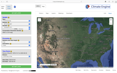
Climate Engine
Developed By: Climate Engine
Summary: Climate Engine is an interactive mapping and graphing tool that allows users to access, analyze, and interact with extensive earth observation datasets for a variety of location and scenario specific analyses.
Hosted by Google’s Earth Engine, the Climate Engine Application allows users to quickly processes and visualize satellite earth observations and gridded weather data via their web browser, without the computational limitations often associated with interacting with big data. This tool provides access to a comprehensive set of variables that provide early warning indicators of climate impacts such as drought, wildfire, ecological stress, and agricultural production. Users can also examine remote sensing data portraying changes in land use, water quality, agriculture, shoreline evolution over time. This tool allows users to generate fully customizable maps and time series graphs for numerous remote sensing and climate data variables. The interface allows resulting maps and graphs to be easily downloaded or shared online. This tool provides a variety of examples, tutorials, and supporting information to guide new users. However, general knowledge of the underlying datasets may be necessary to fully utilize and understand the data products generated by this tool.
Get This Tool: https://climateengine.com/research-app/
Geographic Coverage
- Contiguous United States
Tags
- Registration required
- Historical
- Real-time/Current
- Forecast
- Grid based
- Computer application
- Dataset
- Interactive interface/map
- Compare scenarios/locations
- Downloadable data
- Downloadable results
Cost
- Free
Skill Level
- Medium