Chesapeake Bay Climate Adaptation Toolbox
Drought Risk Atlas
Developed By: National Drought Mitigation Center (NDMC), University of Nebraska School of Natural Resources, United States Department of Agriculture (USDA), and National Integrated Drought Information System (NIDIS)
Summary: The Drought Risk Atlas provides historical drought information for weather stations across the United States through an interactive map viewer and data portal.
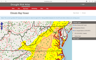
By providing several different drought indices at multiple time steps, this tool provides a variety of options to evaluate drought events throughout the United States. In the map viewer, users can view historical drought information from the U.S. Drought Monitor (2000 - 2012) and Standardized Precipitation Index (1910 - 2012). Additional drought indices and timesteps are available through the data portal for each included weather station. Within the portal, users can search for a station of interest by name or location, then select the specific metrics and timesteps of interest to access station-specific time series plots, tables and rankings. Most of the queried data can also be exported for additional analysis. This easy-to-use tool contains thorough descriptions of the methodology as well as helpful tutorials appropriate for beginner users. However, users should be aware that the available of period of station data may not be completely up to date.
Get This Tool: https://droughtatlas.unl.edu/
Geographic Coverage
- Contiguous United States
Tags
- Historical
- Location specific
- Computer application
- Dataset
- Interactive interface/map
- Compare scenarios/locations
- Downloadable data
- Downloadable results
Cost
- Free
Skill Level
- Medium