Chesapeake Bay Climate Adaptation Toolbox
Virginia Estuarine and Coastal Observing System (VECOS)
Developed By: Virginia Institute for Marine Sciences (VIMS)
Summary: The Virginia Estuarine and Coastal Observing System (VECOS) provides access to water quality and meteorological data from a variety of monitoring programs conducted by the Chesapeake Bay National Estuarine Research Reserve (CBNERR) in Virginia.
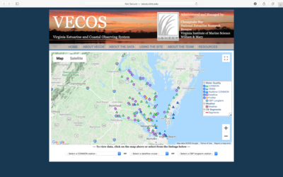
VECOS allows users to view and download historical and recent water quality data collected from long-term continuous monitoring and repeated cruise tracks within Virginia’s Chesapeake Bay. Through this tool, users can easily find water quality data for a location of interest by selecting a station or cruise track from an interactive map, or by name from a list of stations. After selecting a site, VECOS automatically generates corresponding plots or maps of water quality parameters, using the most recently available data from that site. Users can then adjust the dates of interest to update the plots or maps and download the corresponding data. For most sites, users can also find a site picture and description of the sampling location, landscape condition, and monitoring period. In addition to the CBNERR water quality data, VECOS also provides links to additional monitoring programs including meteorological stations, the Chesapeake Bay Interpretive Buoy System, and long-term routine water quality sampling specific to the Chesapeake Bay program. This tool is easy to use and appropriate for beginner users, however further analysis of the data may require additional background knowledge and experience.
Get This Tool: http://vecos.vims.edu/
Geographic Coverage
- Coastal Virginia
Tags
- Historical
- Location specific
- Computer application
- Interactive interface/map
- Downloadable data
Cost
- Free
Skill Level
- Medium