Chesapeake Bay Climate Adaptation Toolbox
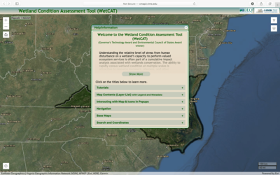
Virginia Wetland Condition Assessment Tool (WetCAT)
Developed By: Virginia Institue of Marine Science (VIMS) Center for Coastal Resources Management (CCRM), and Virginia Department of Environmental Quality (VDEQ)
Summary: The Virginia Wetland Condition Assessment Tool (WetCAT) is an interactive map that assesses wetland capacity to perform ecosystem services and provides the tools to conduct analyses useful for wetland restoration efforts.
Using remotely sensed data, WetCAT scores each wetland’s capacity to perform habitat or water quality services based on its anthropogenic stress condition (i.e., human stressors). The water quality and habitat condition of each wetland are provided as map layers, tables, and graphs. WetCAT has data layers from as early as 2001, which capture features like land surface and land cover changes, to show the change in condition over time. In addition to wetland condition, users can also view additional layers such as shoreline condition, impaired waters, and soils, as well as the distribution of conservation lands and mitigation banks for restoration. Users can also upload their own GIS data or use the provided geoprocessing tools to gather more detailed information about each wetland’s surrounding land use and watershed. This tool provides thorough metadata describing each layer as well as introductory tutorials for new users. However, some background knowledge of wetland functions and processes may be necessary to fully utilize this tool.
Get This Tool: http://cmap2.vims.edu/WetCAT/WetCAT_Viewer/WetCAT_VA_2D.html#abstrShow
Geographic Coverage
- Virginia
Tags
- Jursidiction based
- Grid based
- State level
- Watershed level
- Regional level
- Computer application
- Interactive interface/map
- Downloadable results
- Quarterly
- Weekly
Cost
- Free
Skill Level
- Medium