Chesapeake Bay Climate Adaptation Toolbox
Chesapeake Bay Interpretive Buoy System (CBIBS)
Developed By: National Oceanic and Atmospheric Administration (NOAA)
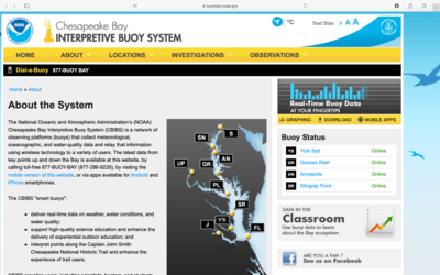
Summary: The Chesapeake Bay Interpretive Buoys System (CBIBS) is a network of ocean observing platforms that provide real-time access to meteorological, oceanographic and water quality data throughout the Chesapeake Bay.
CBIBS allows users to easily view current Chesapeake Bay conditions such as wave height, turbidity, and dissolved oxygen content through an easy to use table and graphing interface. Users access this buoy data by first selecting one of 10 “smart buoys” positioned throughout the Bay. Each buoy has a table interface for current conditions which are collected and updated every 10 minutes. The current conditions all have a link to a graphing interface that shows the variation for the past day, week, or month.
Each buoy location offers data to download as a CSV that includes all of the observations from the past year, or as historical data from 2008 to present. Some buoys are offline as they undergo maintenance, but still display previously collected data. CBIBS also offers a “Data in the Classroom” resource designed for middle and high school science classes, and a presentation for recreational fishermen outlining how CBIBS can enhance their experience on the Bay.
Get This Tool: https://buoybay.noaa.gov/about/about-system
Geographic Coverage
- Chesapeake Bay
Tags
- Historical
- Real-time/Current
- Location specific
- Watershed level
- Website
- Dataset
- Downloadable data
- Subdaily
Cost
- Free
Skill Level
- Low