Chesapeake Bay Climate Adaptation Toolbox
MDOT Climate Change Vulnerability
Developed By: The Federal Highway Administration (FHWA), Maryland Department of Transportation (MDOT), Maryland Department of Transportation State Highway Administration (MDOT SHA), Eastern Shore Regional GIS Cooperative (ESRGC), National Oceanic and Atmospheric Administration (NOAA), United States Army Corps of Engineers (USACE), United States Geological Survey (USGS), Salisbury University (SU), Maryland Metropolitan Planning Organizations (MPO), and Maryland County / Local governments
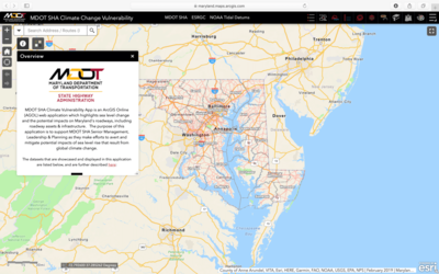
Summary: The MDOT Climate Change Vulnerability tool is an interactive map that illustrates the potential impact of storm surge and sea level rise on roadways and transportation infrastructure in Maryland.
This tool is primarily intended to support MDOT State Highway Administration to avert potential impacts of sea level rise and storm surge on transportation infrastructure, but can also be applied by planners evaluating where a project may be threatened by rising water levels. The map layers are organized to address roadway flooding, general projected flood depth, and roadway incidents, enabling different target audiences to easily access relevant information. The data layers feature extensive projection scenarios, such as the roadway inundation layer which shows 10, 25, 50, 100, and 500-year storm events from 2015’s observed sea level. This layer also shows the same storm event projections for 2050 and 2100. Users can also view past road closure events, including the location, date, and duration a road was closed dating as far back as 2011. The tool also shows FEMA Evacuation Routes, FEMA Effective Floodplains, and projected water depth grids.
This map’s water level projections are based on data from the US Army Corps of Engineers (USACE) Sea Level Change Projections, United States Geological Survey (USGS) studies, and the National Oceanic & Atmospheric Administration (NOAA) tidal observations.
Get This Tool: https://maryland.maps.arcgis.com/apps/webappviewer/index.html?id=86b5933d2d3e45ee8b9d8a5f03a7030c
Geographic Coverage
- Coastal Maryland
Tags
- Registration required
- Historical
- Real-time/Current
- Climate projections
- State level
- Computer application
- Interactive interface/map
- Compare scenarios/locations
- Downloadable results
Cost
- Free
Skill Level
- Medium