Chesapeake Bay Climate Adaptation Toolbox
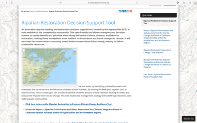
Riparian Restoration Decision Support Tool
Developed By: Appalachian Landscape Conservation Cooperative, United States Forest Service (USFS), and University of Massachusetts
Summary: The Riparian Restoration Decision Support Tool allows users to analyze riparian habitats in order to guide restoration efforts in making riparian areas more resilient to future changes in climate.
This easy-to-use tool allows users to identify restoration areas based on lack of tree cover and shade for riparian habitats in the Eastern U.S. in order to “limit the amount of solar radiation heating the water.” To identify priority habitat areas, users must specify the maximum percent canopy cover and minimum solar gain for areas of concern in an area of interest or for a specific address. Priority restoration areas can be further refined based on a minimum site elevation and maximum percent impervious cover which help identify areas lacking protection from climate impacts. The tool also allows users to overlay layers from a layer panel which includes data about wild trout habitat patches, mean precipitation, and dam locations. Once an analysis is complete, the tool generates a new layer indicating which riparian areas match the provided priority restoration criteria. Although the tool provides background information on how to use the system, it does not give guidance on selecting appropriate parameters. Data in the tool is downloadable and can be imported into GIS software for further analysis.
Geographic Coverage
- Maryland; New Jersey; New York; Pennsylvania; Virginia
Tags
- Historical
- Real-time/Current
- Grid based
- Computer application
- Interactive interface/map
- Downloadable data
- Downloadable results
Cost
- Free
Skill Level
- Medium