Chesapeake Bay Climate Adaptation Toolbox
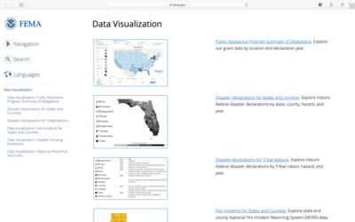
FEMA Data Visualizations of Disaster Declarations and Grants
Developed By: Federal Emergency Management Agency (FEMA)
Summary: FEMA’s Data Visualization tools allow users to explore when and where disaster declarations have occurred across the US through interactive graphs and figures.
These tools help provide important information about the history of disaster declarations by locality and steps residents can take to protect themselves and their communities. Based on FEMA data, users can view the history of disaster declarations by hazard type, location, or year as well as the post-disaster financial support provided to states, tribes, and U.S. territories. Specifically, users can access information and visualizations of Fires, Housing Assistance, and Flood Risks across a range of years. Users have the option to export the graphics or download the raw data. Additional information on disasters and how to prepare for them is provided through this tool.
Get This Tool: https://www.fema.gov/data-visualization
Geographic Coverage
- Contiguous United States
Tags
- Historical
- Jursidiction based
- County level
- State level
- Website
- Interactive interface/map
- Cost estimates
- Downloadable data
- Downloadable results
Cost
- Free
Skill Level
- Low