Chesapeake Bay Climate Adaptation Toolbox
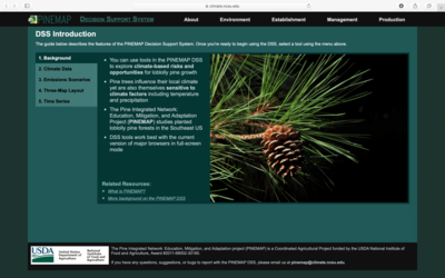
PINEMAP
Developed By: North Carolina State Climate Office, and United States Department of Agriculture (USDA) National Institute of Food and Agriculture
Summary: PINEMAP is a suite of 13 products focusing on loblolly pines in the Southeastern US across four categories: Environment, Establishment, Management, and Production.
The USDA tool is focused on helping foresters understand how pine forests will be affected by climate change, focusing on temperature and precipitation changes. Each tool in this network provides an interactive map, searchable by latitude and longitude, with layers of data for observed historical climate parameters, projected change, and a projected average. Time scale projections run until 2099 and are available in 20-year increments. Two emissions scenarios are available. The low-effort tool is for use by beginner- to intermediate-level tool users.
Get This Tool: https://climate.ncsu.edu/pinemap/
Geographic Coverage
- Contiguous United States
Tags
- Historical
- Climate projections
- Grid based
- Location specific
- Computer application
- Interactive interface/map
- Compare scenarios/locations
Cost
- Free
Skill Level
- Low