Chesapeake Bay Climate Adaptation Toolbox
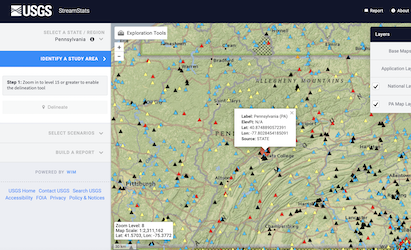
USGS StreamStats
Developed By: United States Geological Survey (USGS)
Summary: The USGS StreamStats: Streamflow Statistics and Spatial Analysis Tools for Water-Resources Applications provides tools for water-resources planning and management, and for engineering and design purposes. Users can delineate drainage areas, get basin characteristics and estimates of flow statistics at user selected sites on streams. Available information varies from state to state.
Get This Tool: https://www.usgs.gov/mission-areas/water-resources/science/streamstats-streamflow-statistics-and-spatial-analysis-tools
Geographic Coverage
- Contiguous United States
Tags
- Historical
- Real-time/Current
- Location specific
- Watershed level
- Computer application
- Interactive interface/map
- Downloadable results
Cost
- Free
Skill Level
- Medium